

Planned schedule from Ingleby Cross to Robin Hood's Bay
Note: all images on this blog can be enlarged by clicking on the image
c2c Cumulative distance St. Bees to Park House, Ingleby Cross - 224.33km - 140.21 miles
AW loved his Lake District, I love the North York Moors. I have walked many miles along numerous footpaths across the moors since 1960 when I first set foot on them, over terrain which can vary from downright dangerous in the wrong weather conditions to soporific with the scent and colours of the heather clad moors on a summer's day. It had been fourteen years since I moved from this area to the East Midlands, so I was looking forward to be back on my home walking territory. Having completed the 42 mile Lyke Wake Walk http://www.lykewake.org/ seven times in the early 1960s from a starting point just above Park House, today's walk brought back a lot of memories.
When planning my c2c route in detail I calculated each day's walk using Naismith's rule and couldn't understand how it was going to take six hours from Park House to Clay Bank when I regularly used to walk it (in the 60s) in three hours or less. Is it anything to do with the (mysterious) aging factor?
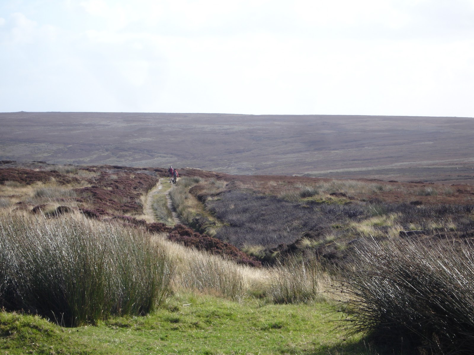
Enough of the reminiscing, time to depart from Park House, the c2c guests, a Canadian group, were well on their way by the time I left just after 10 o'clock. As I came out of the driveway two American ladies, sisters, who's names I forget at the moment [if you are reading this, let me know and I will correct the omissions] were walking up from Ingleby Cross. So we climbed up through Arncliffe Woods together and then, looking back, we saw Paul coming up behind, he soon caught up with us. Suddenly I became the expert (!!) on the North York Moors - a slight exaggeration - but I was able to explain a few things about the area and the Lyke Wake Walk (LWW) in particular to the ladies. In less than an hour we were at the top of the hill looking down on Ingleby Cross, and past the Trig. point, which marked the start of the original LWW.

Looking down on Ingleby Cross
Note: To enlarge the photos in this blog, place cursor on photo and click. To restore, click on 'x' in top right-hand corner of enlarged photo.

Ordnance Survey Trig. point - start of the original Lyke Wake Walk

From Scarth Nick - looking towards Live Moor, with Whorl Hill to the left
From Scarth Nick our path took us across to Scugdale and Huthwaite Green before climbing up Live Moor and on to Carlton Moor in a glorious landscape of purple heather. And, a stone footpath that didn't exist when I was doing the LWW.

Looking back towards Scarth Nick from Live Moor

Climbing up towards Carlton Bank

Looking back from Carlton Bank

From Carlton bank looking across to the Hambleton Hills

Looking across from Carlton Bank to Great Broughton, and Roseberry Topping beyond

Village of Carlton below
After the panoramic views from the top of Carlton Bank we made our way down to Lord Stones cafe http://www.lordstones.co.uk/ by 1.45pm, for a welcome cuppa. A conveniently placed cafe with a good range of snacks, we stopped for about half an hour before starting our climb up onto Cringle Moor.

Cringle Moor looking back towards Carlton Bank and Lord Stones

The track along Cringle Moor

Kirby Bank and Cold Moor

Teesside in the distance

Heather everywhere

Dropping down from Cringle Moor to Cold Moor

Looking across Raisdale to Cold Moor

Kirby Bank and Cringle Moor from Cold Moor
After a brief rest at the Alec Falconer memorial seat, wskirting along the edge of Kirby Bank on Cringle Moor and we then descended on a steep ankle twisting path to a hollow. At this point the American ladies left Paul and I, they were going down to Great Broughton where they were staying the night. We climbed up yet again, this time on to Cold Moor. Today's walk seems like walking on a switchback. As we dropped down the other side, before yet another ascent, we crossed the paths that led to Chop Gate and Urra. I had thought of going that way to Urra - it would save over an hour of walking - but I wanted to follow the c2c as much as possible, perhaps next time.

View down Raisdale towards Chop Gate

There's always something to Grouse about!

The Wainstones

The Wainstones close up
Once we reached the top of Wainstones, we found a sheltered place to have the final snack of the day before dropping down to Clay Bank where Paul was going to be picked up by the owner of his B&B at 4.45pm

Urra Village - Our B&B is among the large group of trees

Urra Moor and the path to my accommodation
I still had to climb from Clay Bank, following the c2c and Cleveland Way, up Carr Ridge to a gate in a wall and then head south along the escarpment above Bilsdale [follow the path upwards, in the above photo, to where it meets a wall]. The light was starting to fade as I reached the gate to head south, just time for a couple of photos then must get a move on it was 5.15pm.

The Wainstones from Carr Ridge

The Wainstones from the path to Urra on Urra Moor
The path wound around a couple of small valley heads before arriving above the village of Urra. At first I took what appeared, on the map and on the ground, as the easiest route but this soon developed into landslips and large holes, so I had to back-track on to the top again. I could see Mary, and our landlady, waving to me, so I waved back, then found a way down. This confused them because apparently they were waving me to go a bit further south, but then I disappeared amongst all the bracken, before crossing a field when they were looking the other way. I arrived at 6.00pm, a total of eight hours, six hours walking for 22.5km (14.0miles).
Maltkiln House is a delightful little hideaway, Wendy and Gerry provide a genuine warm welcome - to the extent Wendy was helping Mary to look out for me. Again, we had had a problem with mobile phone reception, so were unable to communicate. Not having to seek a pub for our evening meal was a welcome relief, as we were dining in, we were not the only guests so it was a very pleasant evening. Gerry gave an informative talk on jet mining on the moors - all very relaxing.
The website for Maltkiln House for contact information is: http://www.maltkiln.co.uk/
Today's c2c distance - 22.50km - 14.06 miles
c2c cumulative distance - 246.83km - 154.27 miles
Wednesday 21st September - Urra (Maltkiln House) to Lion Inn, Blakey
Yet another good night's sleep, it must be all this fresh air. And, that switchback of a walk yesterday with six climbs, none very high, ascents ranging from 75m (250ft) to 300m (1000ft). Today's walk was going to be relatively easy. We just had to climb up on to Urra Moor from the B&B, follow the wall south for a few hundred metres and then pick up the track rising from Chop Gate up to Round Hill. Here we only had to veer right to be back on the c2c path, heading for the disused railway line to Blakey. Mary had decided to do today's walk with me, so that was good.
We left Maltkiln at 10.00am, again our fellow guests had already departed, we were in no hurry - but we did have to climb up on to the first, an ascent of about 75m (250ft) which would get the leg muscles warmed up. Gerry and and Wendy waved us off - lovely people.

The way up on to Urra Moor - along side the stone wall, centre of photo
The day was dry with blustery winds but nothing that hindered our climb up on to the moor. As we approached Round Hill, the highest point on the moors, c2c walkers could be seen coming up from Clay Bank, and others already on their way to Blakey.

Mary had a little lamb ... or ('where is Eilidh, my Border Collie when I need her')

Weather a little bit blustery!

A bleak outlook
Within an hour we had reached Round Hill where we couldn't resist photographing two unusual boundary stones.

'Hand' boundary stone

'Two Hand' boundary stone

Mary with 'face' boundary stone
Having passed Bloworth Crossing we had our first views down into Farndale - a beautiful dale, especially in Spring when the daffodils are in full bloom. Bloworth Crossing marks the intersection of the ancient footpath from Farndale and the railway line. The railway line was built in the 19th Century to carry iron ore from Rosedale, where it was mined, to a steep incline controlled by pulleys and horses, from there it was taken to the new booming iron and steel foundries built around, what was then, the new town of Middlesbrough. When cheaper, and better sources of ore where found the railway fell into disrepair - to the benefit of 'us walkers'!

Just after Bloworth Crossing - looking down Farndale

Moorland scene

Now on the disused railway line - easy walking

Another view of Farndale
At 1.30pm we found some shelter from the strong wind by dropping down the north side of the railway embankment, where we had lunch with glorious views down towards Westerdale.
Half an hour in the sunshine and out of the blustery wind, I could have almost had a snooze. But snack over, it was time to move on - after all the bar in the Lion was only an hour away.

Another view of Farndale

Mary striding out

Nearly there

The Lion Inn

Let's get in that pub, out of this wind!!
We arrived at the Lion just after 3.00pm, a total of five hours with 4hrs 30mins walking time, for a distance of 14.6km (9.12miles).
The Lion Inn stands at the highest road crossing of the North York Moors, the accommodation is very comfortable the food is good, and the beers are excellent - as a couple of pints of Black Sheep proved. It is all downhill now, more or less, to Robin Hood's Bay - nothing to with the beer.

The Lion Inn copyright Lion Inn, Blakey Ridge
Today's c2c distance - 14.60km 9.12miles
c2c cumulative distance - 261.43km - 163.39 miles
Thursday 22nd September - Lion Inn, Blakey to Grosmont
There was quite a gathering in the sunshine outside the Lion Inn as we emerged after breakfast. Some were waiting for friends who had been accommodated elsewhere. Mary had decided to do a major part of today's walk of approximately 22km (14miles), going as far as Glaisdale, where we could have a drink and something to eat before finding a taxi or train to take her toGrosmont. Paul had stayed the night in Farndale and joined us as we left Blakey at 9.30am. Ahead, walkers were in groups spaced out along the road which runs along Blakey Rigg towards Ralph's Cross.

And they're off!

More walkers leaving the Lion Inn.

Rosedale
Having turned right at Ralph's Cross along the Rosedale road, we made a brief stop at Fat Betty, another carved boundary stone. Here, we added a few boiled sweets to the snacks left for other wayfarers.

Across the moor to Ralph's Cross

Fat Betty - marker stone

... and Fat Betty makes three!

Some of the snacks left on Fat Betty

Across the moor towards the Lion Inn
Shortly after leaving Fat Betty we turned left on to the moorland, following a track down to Trough House, an old shooting lodge. Then it was eastward towards Glaisdale Rigg with glorious views down Great Fryup Dale - nothing to do with the great English breakfast, supposedly named after the Norse goddess Freyja.

Trough House - old shooting lodge
View forward from Trough House

Great Fryup Dale

Great Fryup Dale
At this point Paul decided to press on with some faster walkers, while we ambled around the head of Fryup Dale to the Lealholm road, which we followed for a couple of kilometres until we picked up the trail down Glaisdale Rigg. Once on the Rigg, we found a comfy spot in the heather for a well earned rest and a bite to eat at 1 o'clock. We were back on our feet after 20 minutes and soon the village of Glaisdale started to appear over the horizon as the hillside dipped away into the Esk valley.

Approaching Glaisdale

Approaching Glaisdale
Within an hour of our last break we had walked through the lovely village of Glaisdale and were seeking the Arncliffe Arms at Carr End for a drink and decision time for Mary. Taxi or train?

Glaisdale from Carr End
Over a couple of drinks and freshly made cheese and ham sandwiches in the cafe below the pub, part of the Arncliffe Arms, http://www.arncliffearms.co.uk/ we decided not to rush for Mary's train, instead, we booked a local taxi, to take her to Grosmont.
By 3.15pm I was on the road down to the River Esk to view the Beggars Bridge, a stone bridge built by a 'poor boy made good', Thomas Ferris in the 17th century.

Beggars Bridge
As I walked through East Arncliffe Woods I spotted an angler on the opposite river bank. My attention was caught by the sudden tension in the line and watched as angler and fish played each other. A flash of silver as the fish surfaced (salmon or trout? - I think the former), then slowly the angler reeled in and landed the fish in his keep-net.

Gotcha!
Moving on through the woods, I climbed above the Esk and then, just as quickly, dropped down into Egton Bridge. Here, I crossed the the Esk on the old stone bridge before turning right to follow the old toll road through Egton Estates. The toll road presented a quick, level road between Egton Bridge and Grosmont compared with the steep hills on the regular road.

A leisurely afternoon for some!

Toll Fees
The toll road brought me to the outskirts of Grosmont and by 4.50pm I was leaning on the level crossing gates looking at the well maintained railway station.

Missed the train!
Our B&B, Ings Bank run by Mr & Mrs Smith, was just a couple of hundred metres from the station at the end of a side road - Mary had arrived 30 minutes earlier. And what a find it turned out to be. Afternoon tea in the conservatory and a huge bath, in the Edwardian style bathroom, to soak in. Mrs Smith was away on family business, Robert her husband couldn't do enough for us - marvelous - well recommended. That evening we had our evening meal in the Station Tavern http://www.stationtavern-grosmont.co.uk/ - met with Paul who had a good day. I had yet another steak pie - the staple diet of the c2c walker - washed down with Real Ale. Paul and I arranged to meet next morning about 9.00am, if possible.
I arrived at the B&B some 7 hours and 20 minutes since leaving the Lion Inn, a total walking time of 6 hours for a distance of 22.54km (14.1 miles).
Today's c2c distance - 22.54km 14.10miles
c2c cumulative distance - 283.97km - 177.49 miles
Friday 23rd September - Grosmont to Hawsker (York House)
A good night's sleep and a leisurely breakfast meant that I missed Paul at 9.00am. The breakfast in the conservatory was worth taking our time over. Robert had gone to a lot of trouble ensuring everything was just right, especially as I had asked for scrambled eggs with my bacon - he wasn't sure that he could do them 'to his wife's standards - there were excellent. [no yolking about being eggcellent - boom boom!].
Eventually left Ings bank about 10.10am, obviously missed meeting up with Paul - so I will do it my way. There was quite a dampness in the air as I set off, though it would prove refreshing with what was to come - a 2km climb up a 1in 3 hill. Another Wainwright brisk start. Stopping only for a couple of quick photos on the way up, I made my way up the muscle stretching ascent without too much trouble - after all, this was the type of terrain I had been training on, 'easy-peasy', and my Garmin was telling me that I was averaging over 4km per hour.

Esk Valley and Grosmont
As I reached the top of the hill, I could see walkers in the distance ahead of me. By the time I had skirted Flat Howe on Sleights Moor, crossed the A169 and walked into Littlebeck I had caught up with an Australian couple and then two young American ladies, who I had met in the Lake District - seems like an eternity.

Littlebeck
While I recognise that the c2c is not a race, my attitude is that it should be an amble across England's green and pleasant land, it was pleasing to me as someone rapidly approaching 70 (4 days away) that after two weeks of walking I could still average between 4 and 5 km per hour. After ambling through the village's picturesque setting I found myself in Littlebeck woods heading for Falling Foss and its tea-gardens. On the way I passed the 'Hermitage', a huge boulder within which a shelter had been carved, complete with seats. It is dated 1790 and has the initials GC carved on the outside wall.

The Hermitage


Falling Foss
Just after the Falling Foss are the Falling Foss Tea-rooms and gardens and I was ready for a cuppa. Seated at the benches there was a lovely surprise, Debbie and Paul, the couple from Bristol, and Dave. Debbie and Paul I had last seen at Keld setting up their tents, and Dave I had last seen when we shook hands, wishing each other good luck, as we went our separate ways outside Orton village. it was really good to see them.
http://www.fallingfossteagarden.co.uk
Refreshed, we set off together for the 9km (5.5miles) walk to Hawsker through Littlebeck Wood, May Beck and up on to Low Sneaton moor. Despite a few boggy spots, which we came through unscathed, the moorland was a welcome grassy walk, providing us with our first full sight of the North Sea. It brought home to me just how long I had been walking across England - getting up every morning, boots on and stepping out into the English countryside for fourteen days had become a way of life. I felt as though I could go on doing this for ever - and enjoy it!

Debbie, Paul and Dave with North Sea on the skyline

Grassy moorland track

Paul, Debbie and me
The road sign might say three and a half miles to Robin Hood's Bay, but Wainwright wasn't a very direct person, for our c2c route was going to be another five and a half miles (9.8km). We arrived in Hawsker at 2.35pm, just four and a half hours after leaving Grosmont (4 hours walking) for 17.6km (11miles).
A most enjoyable day finished, for me, sitting on a bench in the middle of Hawsker eating my packed lunch alongside some fellow c2c walkers. We said our farewells as Debbie, Paul and Dave headed off for their last stage into Robin Hood's Bay. I was very tempted to join them to complete the c2c with some special friends; it was still early and I could have easily got a taxi back to Hawsker. But, tomorrow is already planned as my very special day and didn't want to detract from that. I was looking forward to the four and a half mile walk along the cliff tops with Mary, my children and all my grand-children, also my sister, Sandra, and my cousin, Terry.

York House, Hawsker
As I made my way to York House http://www.york-house-hotel.co.uk/ a feeling of emptiness came over, the realisation that after tomorrow the days were going to be different. I had spent 12 months planning the details and training to achieve this goal; I had walked for two weeks across England without ache, pains nor blisters. How do I follow this, is the question?
I arrived at York House before Mary, so sat in the bar and had a beer or two. Soon, not only Mary but also Sandra and Terry arrived and after a quick discussion, and a few more beers, we settled on eating at the Hare and Hounds http://www.hareandhoundshawsker.co.uk . Both the food and the beer is excellent, highly recommended.
Today's c2c distance - 17.60km 11.00miles
c2c cumulative distance - 301.57km - 188.49 miles
Saturday 24th September - Hawsker (York House) to Robin Hood's Bay
Well, journey's end. But first the family have to gather; Rachel and family travelling from Tyneside, without Ash unfortunately as he was working in an operating theatre; my daughter, Saira, was working in TV studios, so husband Tim and Eliza (she of the squelchy spots on Greenup Edge) travelled over from West Yorkshire; Jonathan, my son, and family (with Tilly, the dog) had travelled up from Warwickshire and Angela, my step-daughter from Hertfordshire. In addition my sister, Sandra, who had arrived from Bristol yesterday, and my cousin Terry from Middlesbrough. It was going to be quite a family outing. Rather than write a descriptive text, you will have to make do with a lot of photos and associated comments.

I'm ready. C'mon Gill fasten those laces. Notice Jon (the Executive son setting up a business conference call (on a Saturday? - like father like son!)

Not all quite present and correct, Ashley and Saira are working.

From L - R: Angela, Rachel, Jack, Hannah (with Issie hiding behind), Jon, Mia, Gill with Amy in front, behind Amy is Eliza, and behind her is Sandra, Terry, me and Tim, and Tilly the dog.

It's 10.20 and we are off!

Looks like a family ramble

At last! The east coast of England and the North Sea

Tim taking a photo of Ness Point

Anyone know the way to Robin Hood's Bay?

Children having some fun with Gill

Robin Hood's Bay - almost there

Everyone waiting for Grandad to catch up - he's too busy taking photos

Robin Hood's Bay

Amy using the kissing-gate as a toll gate, wanting everyone to pay
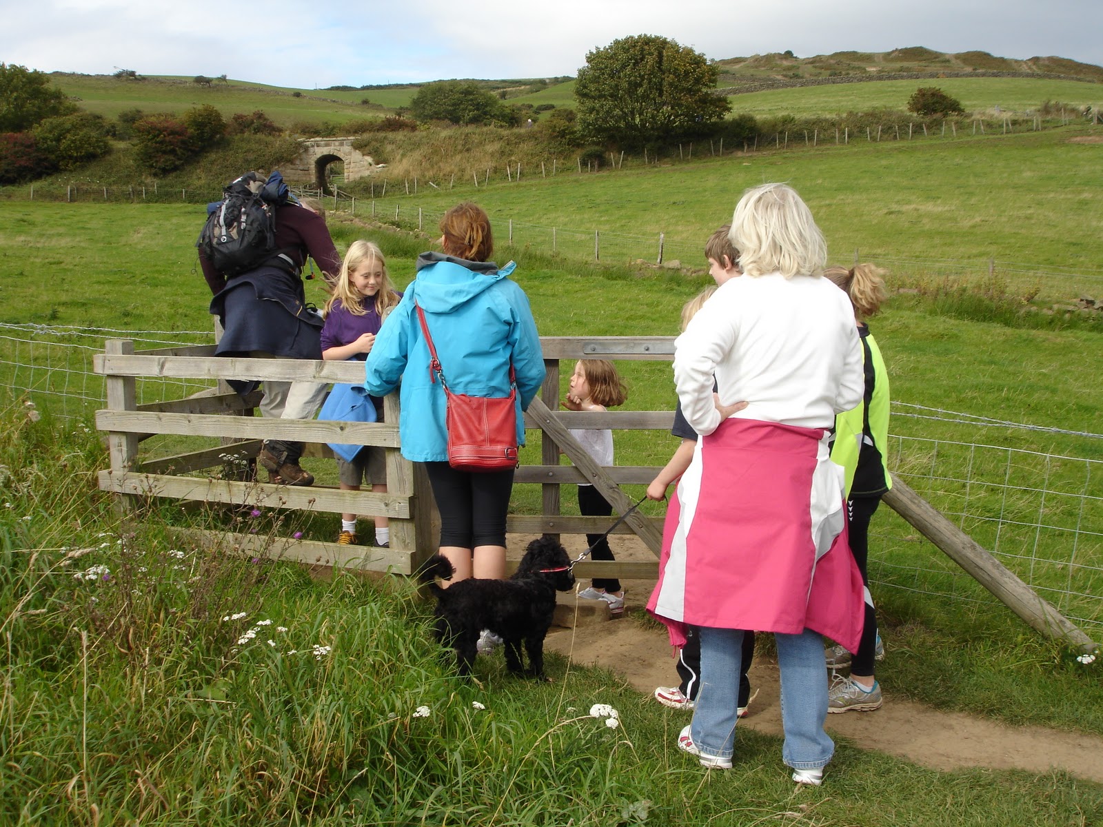
Grandad is a pensioner and can't afford to pay so he climbs over the stile - Amy looks non-plussed

This way, Tilly

First Coast to Coast completed. That's it - feet in the North sea. Look like Neptune

See I did get my feet wet!

We are in this together, kid!

There's the sign, now where is the beer?

Thirsty walkers

Cheers Grandad!

Terry and me

Sandra, me on my second pint, and Terry

Kevin, from Melbourne, he of the 20kg rucksack, we hadn't seen each other since Ennerdale

Plaque commemorating J Arthur Rank's making of his first feature film, in Robin Hood's Bay
Today's c2c distance - 7.20km 4.50miles
Final c2c cumulative distance - 308.77km - 192.99 miles
******
t'was only a ramble after all!
***

******
t'was only a ramble after all!
***

Farewell Robin Hood's Bay - 'til the next time