

Planned Schedule from Shap to Ingleby Cross
Note: all images on this blog can be enlarged by clicking on the image
Wednesday 14th September Shap to Kirkby Stephen
Well here we are, ready to start the next stage. So far I have achieved 60miles (95km), squelching my way through the Lake District and have enjoyed every step (some may say masochistically). Now there are the Westmoreland Plateau with its limestone pavements, and the Yorkshire Dales to meander through, a vivid green patchwork stitched together with dry stone walls and patterned with deserted old stone barns. An area very well known to me and I feel as though I am on my way home.
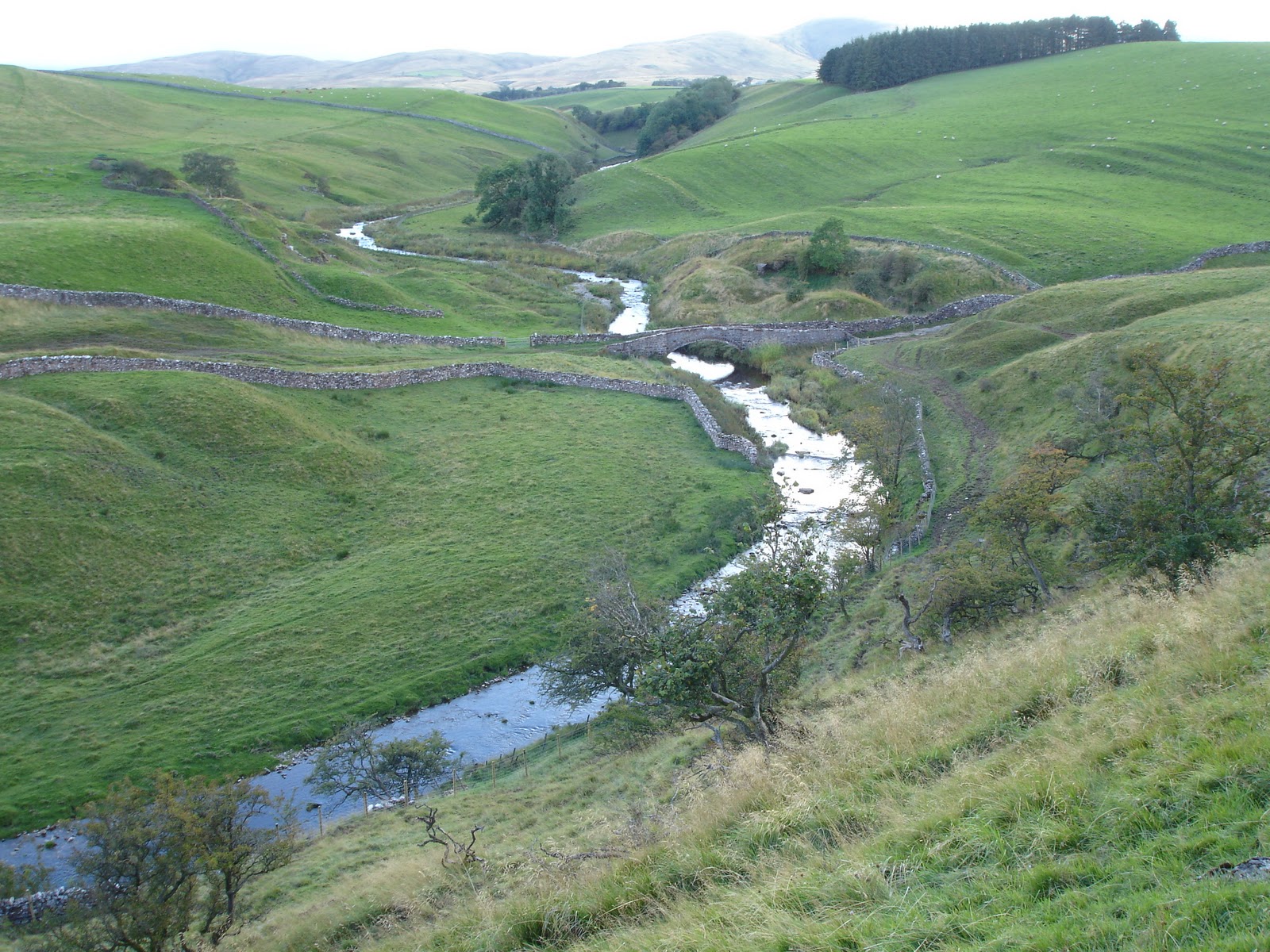
After a good night's sleep, a full breakfast to fuel my day's walk of 32 km (20miles), and a good packed lunch in my rucksack (for further fuel), I was ready to leave Brookfield House by 10.00am. Others, including Andrew and Dorothy who I had met on a number of occasions earlier in the walk and would be 'bumping' into quite often before reaching Robin Hood's Bay, had left much earlier. To access the Westmoreland Plateau, an area of limestone pavements thrusting up through a soft grassy landscape, which forms the major part of today's route, one had to cross the M6 motorway - fortunately there is a footbridge! There is a convenient track at the side of Brookfield House which winds its way across a couple of fields to the footbridge. Anyone staying at the north end, or the centre, of the village accessed the M6 crossing using the path recommended by AW. As headed across the fields, keeping one eye on the young bullocks who were gazing at me with curiosity, I could see a party of walkers travelling down the other trail and just about to reach the bridge. After so much peace, tranquility, and even solitude through the Lake District, the short march across the footbridge with traffic under my feet hurtling north and south, drivers hunched over steering wheels, tense 'must get there asap' expressions on their faces, was quite a shock to the system. Despite all the hard walking, clambering up rocky inclines (e.g Haystacks) and the exhilaration of Grisedale , I had attained a good level of mental relaxation. This was now being abused with reminders of long forgotten high speed commuting. I scurried across attempting to blot out this mental intrusion. Passing the rabbit warrens (don't mention overcrowded cities!) I veered left towards Hardendale quarry and the wooden steps arrangement to circumvent the quarry workings - another intrusion on the landscape (I feel a rant coming on!). Fortunately, the walk became more relaxing as I skirted around the small hamlet of Oddendale and I realised that I had accomplished about a third of the total distance of the c2c. Noticing the American group of about 9 or 10 walkers investigating the limestone pavement to my right, I made my way down the broad grassy track - hoping to make up some distance after my late start. Not stopping, apart from taking a few photos (below) until finding my own limestone pavement to investigate.

Beautiful walking country ahead

Looking back towards American party making their way down between the groups of trees

The limestone pavement that I inspected!
Note: all the photos in this blog can be enlarged by just by pointing the cursor and clicking - restore by clicking on the 'x' on the top right hand corner of the enlarged photo.
After a muesli bar and a piece of Kendal mint cake, I was on my way again. The way forward was quite clear - no sight of any walkers ahead. A giant 'erratic' boulder looked as though it wanted to accompany me down the hill to the Lyvennet Beck. Wonder if the vibrations from the tramping feet of the masses following me might send it on its way. An erratic boulder rock is one that is different to the local rock, having being dumped by receding melting glacial ice.

Roll on, Rock!
As I clambered up the other side of the beck, Dave, who had also been staying at Brookfield House, caught up with me just as I was taking a photo-shot break - of which there are numerous opportunities.

Looking across the Eden Valley towards Dufton Fell
Dave was only going as far as Orton, so we walked, and talked, for about an hour to a point above Broadfell Farm where he headed for the village.

From above Orton looking across towards the Howgills
I made my way to Scar Side Farm for a pot of tea and toasted teacakes. A good stopping place for refreshments, looks good for B&B as well. http://www.scarsidefarm.com/index.htm [NY632 092]. Sitting in the garden of Scar Side Farm, enjoying the last of the tea in the pot, a Packhorse vehicle pulled up in the drive. At first I thought it might have been the mini-bus carrying Mary and I had been found out 'supping my way across England'. Turned out that because of the 'walking chaos' caused by hurricane Katia, people injured from falls and others finding the conditions too difficult for walking, were skipping sections and using the mini-bus thus leaving little space for luggage, so additional vehicles were being brought into service. Other companies providing similar services were having the same problem.
Now dear reader, especially experienced c2c walkers, can you help me out with this little problem? The photograph above was taken at 12.47 (according to my camera) at a point where the c2c path crosses the Orton to Crosby Ravensworth road, just north of Orton. I then walked to Scar Side Farm, where I spent about 30 to 40 minutes, before heading off towards Sunbiggin

Failing the aforementioned sources, I checked on Google Earth (a great toy) - some interesting possibilities just before Acres farm - but to no avail. I cannot recall whether I went through the gateway, there is an adjacent footpath sign, or walked on by! Anyone recognise it??
Anyway, onwards, striding past Sunbiggin Farm, across Tarn Moor and on to Ravenstonedale Moor where I managed to keep my feet dry despite some 'suspect' stepping stones. It was getting close to 16.00 as I approached Bent's Farm, with still 10km (6.25miles) to Kirkby Stephen - note to self 'must get started earlier', but not without breakfast, I seem to be forever chasing the daylight.

The Howgills, in the distance, from near Bent's Farm

The Howgills, in the distance, from near Bent's Farm

Looking across the Severals' Settlement
As I walked around the edge of Severals, I couldn't help wondering what the ancient civilisation would have made of the thousands of people, of the modern era, who wandered past their ancient doorsteps every year in the name of a good walk!

Giants' Pillows
A view of Smardale Bridge from the track down from Severals
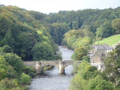
By the time I had crossed Smardale Bridge, over Scandal Beck, it was 16.30, dusk wasn't very far away but there was time, and light, for one last photo of the day before climbing on to Smardale Fell. The subject? Smardale viaduct with its fourteen arches straddling the valley, built in 1861 - these Victorian structures always seem to sit well in the landscape, I think so.

The Fourteen Arches of Smardale Viaduct
After the photo 'shoot' there was still 6.5km (4miles) to walk, fortunately it was a good track with a limestone and grass surface - time to stride out if I was to get to Kirkby Stephen before dark. Coming down off Smardale Fell, the Eden valley was laid out before me with Mallerstang, and tomorrow's challenge 'Nine Standards' on the sky-line'. But where was Kirkby Stephen? All I could see was a convergence of valleys filled with trees. Soon, across a couple of fields, under a railway line and the market town soon started to emerge in the early evening gloom. Unlike at Shap, our accommodation was close to the point of entry into the town - so no long slog down a seemingly never ending main street.
Fletcher House http://www.fletcherhouse.co.uk/index.html is a very well appointed guest house with comfortable rooms and a warm welcome guaranteed from Stephen and Gillian, our hosts. It is handily placed for pubs, shops and ATMs.
Mary had spent an hour or so wandering around the town and seems to have fallen in love with the place - is there to be a move from Tuscany to Cumbria (?). Watch this space!
I was more concerned with getting a shower after 31.5km (19.7miles). It had been eight hours since leaving Shap with a walking time of seven hours. For the last 19km (12miles) I hadn't seen a solitary walker - where were they all? I found them all filling out the pubs, there were plenty of them in the Black Bull that night!
Day's distance - 31.50km - 19.68 miles
c2c cumulative distance - 126.73km - 79.22 miles
Note: All the distances quoted in this blog are as per my GPS Foretrex device in kms. The conversion to miles are my own calculations (ie km x 5/8 = miles), and are therefore approximate.
Thursday 15th September Kirkby Stephen to Keld
15th September, today celebrates 53 years since the day I started work as a trainee telecomms engineer in Shropshire, and also 10 years and 2 weeks since I retired - my working life over in a flash!
For once I managed to make a reasonably early start - 9.00am! After the previous couple of days of relatively flat walking, we were back to AW's little trick of starting the day with a muscle-stretching climb. Over Frank's Bridge, through Hartley village and skirting its associated quarry was quite easy. Then the climbing started but soon the effort was rewarded with views over to Highlong Rigg.

As the first hour approached I had a brief respite on the 'rest-a-while carved seat with some fine views across the Eden valley to Stainmoor and also back-over at Kirkby Stephen.


Onward and ever upward across Hartley Fell with Nine Standards becoming clearer by the minute.

At this point the route splits into three separate paths, identified as Red, Green and Blue, for three different times of the year. The aim is to attempt to manage the soil erosion caused by the thousands who tramp across these fells each year. Only the Red and Blue routes go up to the Nine Standards cairns. I was following the Blue route (August-November) and reached the top at 11.00am. Quite a few had already gathered there, and there were more following. I reckon there were more than 25 walkers at Nine Standards during the thirty minutes I was there.


The farmer was busy with his sheep and sheepdog, so I took a short video hoping it might give our Border Collie, Eilidh, back home, some idea of what life could have been like for her. (She was not impressed with noisy sheep).

Soon there was a straggling line of walkers along How Edge Scars heading for Swaledale and Keld.


Mary, having walked up from Keld, was at the junction of the track and the road (B6270) waiting for us. We then had a pleasant stroll into the village, enjoying the Swaledale scenery on the way.


Just before reaching Keld, we spotted Debbie and Paul putting up their tent at Park House http://keldbunkhouse.com/Camping - said they were looking forward to being served breakfast in bed, ha ha!
Arriving in Keld at 3.45pm after an enjoyable day's walk, and still with no blisters or aches and pains, I was ready a pint of Black Sheep - it didn't touch the sides - to celebrate reaching the halfway point on the c2c. Our accommodation, Keld Lodge the former Youth Hostel, provided excellent rooms, service, food, and of course beer - a bit pricey compared to others on the way, but good http://www.keldlodge.com/index.htm .

Total time today was 6hrs. 45mins - walking time 5hrs 15mins.
Thursday 15th September Kirkby Stephen to Keld
15th September, today celebrates 53 years since the day I started work as a trainee telecomms engineer in Shropshire, and also 10 years and 2 weeks since I retired - my working life over in a flash!
For once I managed to make a reasonably early start - 9.00am! After the previous couple of days of relatively flat walking, we were back to AW's little trick of starting the day with a muscle-stretching climb. Over Frank's Bridge, through Hartley village and skirting its associated quarry was quite easy. Then the climbing started but soon the effort was rewarded with views over to Highlong Rigg.

Highlong Rigg from near Fell House
As the first hour approached I had a brief respite on the 'rest-a-while carved seat with some fine views across the Eden valley to Stainmoor and also back-over at Kirkby Stephen.

Looking across the Eden valley to Stainmoor

Looking back at Kirkby Stephen
Onward and ever upward across Hartley Fell with Nine Standards becoming clearer by the minute.

The climb up to Nine Standards
At this point the route splits into three separate paths, identified as Red, Green and Blue, for three different times of the year. The aim is to attempt to manage the soil erosion caused by the thousands who tramp across these fells each year. Only the Red and Blue routes go up to the Nine Standards cairns. I was following the Blue route (August-November) and reached the top at 11.00am. Quite a few had already gathered there, and there were more following. I reckon there were more than 25 walkers at Nine Standards during the thirty minutes I was there.

Nine Standards Rigg, with the cairns becoming prominent

Me at Nine Standards
What are the Nine Standards? Their origins are not known, the popular theory is that the nine cairns were built centuries ago by an English army to make any marauding Scots think it was an army encampment on the top of the hill. They could have been built as beacons, or because their location on this rigg, being a high point on the Pennines and the divide of the watershed of English rivers going east and west, they may simply be cairns erected at the junction of old political boundaries.
The following short video shows views starting towards the south-south-east, panning around south-west towards Mallerstang and beyond, then west to the Eden valley and Kirkby Stephen, and back to the trig. point on Nine Standards.
.
Enough of messing about with cameras, back to the serious business of getting to Keld, first we have to traverse the peat haggs. With over twenty-five walkers attempting to find a 'dry' way, and having learned from my experience of following my grand-daughter Eliza over Greenup Edge and its 'wet bits', I decided let the younger ones splodge around until a path could be identified. Actually it was quite easy, aided by one or two marker posts and only standing on the base of clumps of reeds - I avoided getting a foot wet, or wrapped in black soggy peat. Thank goodness, as I had only just got my two pairs of boots properly dried out after the Lake District. Having cleared the peat bogs we were rewarded with great views down Whitsundale, the golden grasses catching the sunlight on a day that had provided the best weather of the walk so far.
Whitsundale
By 1.00pm I was ready for something to eat, and found a comfortable spot in the grass at the head of the dale. Admiring the view down the dale as I munched away, the warm sun soon got to me - time for a 10minute snooze. A couple of young guys from Stuttgart found a similar spot nearby, waking me from my slumbers, it was time to press on.

Whitsundale from my 'snooze spot'
An hour late found most of us gathering at Ravenseat Farm hoping for tea and cakes but unfortunately the farmer's wife was busy elsewhere that day - the story of this walk!! So it was packed lunches all round.

Ravenseat Farm, for a cuppa, possibly.

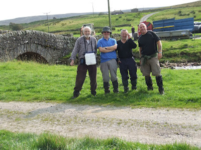
Ravenseat Farm, Kevin on left, Paul at front

(copyright K. Legge)
Me, Paul, Paul and Kevin at Ravenseat Farm
The farmer was busy with his sheep and sheepdog, so I took a short video hoping it might give our Border Collie, Eilidh, back home, some idea of what life could have been like for her. (She was not impressed with noisy sheep).

Eilidh - 'What, me chase sheep?'
Soon there was a straggling line of walkers along How Edge Scars heading for Swaledale and Keld.

Wooded ravine about 1km beyond Ravenseat

Swaledale and the road into Keld
Mary, having walked up from Keld, was at the junction of the track and the road (B6270) waiting for us. We then had a pleasant stroll into the village, enjoying the Swaledale scenery on the way.

River Swale

River Swale and Cottersby Scar (cliffs on the left)

Approaching the road into Keld, from Whitsundale

Ol' man river!

Cottersby Scar

Wainwath Force

Cottersby Scar

Towards Keld
Arriving in Keld at 3.45pm after an enjoyable day's walk, and still with no blisters or aches and pains, I was ready a pint of Black Sheep - it didn't touch the sides - to celebrate reaching the halfway point on the c2c. Our accommodation, Keld Lodge the former Youth Hostel, provided excellent rooms, service, food, and of course beer - a bit pricey compared to others on the way, but good http://www.keldlodge.com/index.htm .

View from the bedroom in Keld Lodge
Day's distance - 19.00km - 11.87 miles
c2c cumulative distance - 145.73km - 91.09 miles

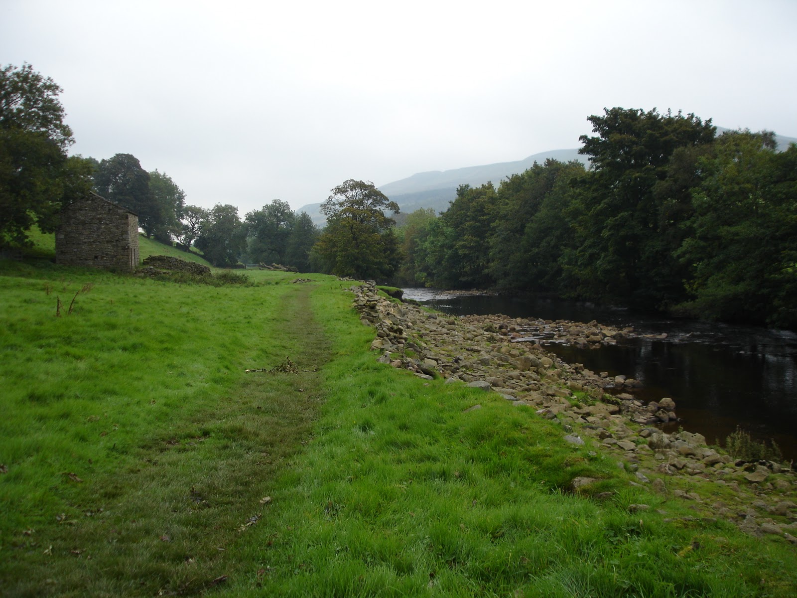
Managed to get away early, again, this morning, 09.00am, in what was promising to be a misty day. Today's walk was going to be relatively easy, as I had already decided to take the alternative low route along the banks of the Swale rather than 'go over the tops' through the old mining area. I have been in that area before, albeit many years ago - the misty weather only reinforced my decision. I met up with Paul just outside Keld so we walked the day together. The banks of the Swale, a scattering of old stone barns and dry stone walls dividing the vivid, verdant landscape made walking such a pleasure - with plenty of the feel good factor.


Although dry stone walls had been in use much earlier, many of them were constructed in the late 18th and early 19th century as a result of the Enclosure Acts. The walls are constructed without mortar, as two walls linked together with key-stones every so often. For more information visit the Dry Stone Walling Association's website http://www.dswa.org.uk/index.asp .
Walking at a leisurely pace, we headed for Gunnerside hoping to find a friendly 'caff' for a pot of tea, pausing briefly for a photo of an old stone bridge across the Swale near Ivelets.


Arrived in Gunnerside just before noon to find the tea-shop, and the pub closed - yet another! The pub was due to open at mid-day so we waited a while - I said it was going to be an easy day. Suitably refreshed after yet another pot of tea, we set off up the incline out of Gunnerside for the open moorland, taking a few photos on the way, of course.


Coming off the moor we passed through several small hamlets before reaching Healaugh, where the path led us down to the banks of the Swale again. Mary had walked from Reeth to meet up with us for the last mile - and to show me the way to our accommodation at Springfield House.
http://www.springfield-house.co.uk/index.html
We had a warm welcome from Denise and her husband, followed by tea, scones and home-made jam which were delicious and really appreciated.
That evening we ate at the Kings Arms, the Giant Yorkshire Pudding with roast beef was great. Some fellow c2c-ers who I had met at Nine Standards were in the pub with their own organised mini trivia quiz!
Saturday 17th September Reeth to Richmond
Another damp start to the day as I left Springfield House at 9.15am and made my way through Reeth.


On the edge of Reeth, just as I was crossing Arkle Beck, I caught up with Paul with whom I had walked on previous days. We continued alongside the beck to its junction with the Swale through Grinton. Despite the dampness in the air it was a pleasant and quiet walk along the grassy riverbank and then up onto higher ground towards Marrick Priory.

Marrick Priory was built for Benedictine nuns in the 12th century, and so it remained until Henry VIII's reign and his Dissolution of the monasteries. It is now used as an adventure centre by the Diocese of Ripon.


As there aren't any refreshment stops in Marrick, we made a bee-line, using the road rather than crossing the fields, for Nun Cote Nook farm where we were assured we could get a cuppa at Elaine's Country Kitchen. But, as we have found so often on this walk, it was closed! There is bound to be somewhere, we thought, and it was only 10.30am. So we picked up the c2c path behind the farm and made our way across the fields to Ellers and on to Marske. The church, St. Edmund the Martyr, in Marske 'built on the site of an earlier church dating back to 1090' (Stedman H. (2010), Coast to Coast Path, p180) provided us with a delightful find. In the lane near the entrance to the church there is a great tea room, The Lodge Tea-rooms, with home made cakes using organic produce. It is in a perfect setting, the garden is laid out with tables and benches and, if the weather is inclement, there is a spacious conservatory. Highly recommended. http://www.facebook.com/pages/The-Lodge-Tea-Room-Marske/121337271282516
Suitably refreshed, we reluctantly left the tea-rooms for a walk of a mile, or so, across the fields to Applegarth Scar, then turning right at a white cairn we headed in almost a straight line for Richmond.


From West Applegarth Farm we had a grand view of the rolling Swaledale countryside.

In less than an hour we had our first sighting of Richmond, and the Vale of Mowbray, with an outlineof the western edge of the North Yorkshire Moors on the distant horizon.

Mary met us about two miles outside Richmond, having sussed out the location of the B&B, our accommodation for the next two nights as Sunday was a rest day. http://www.nunscottage.co.uk/ Nuns Cottage is very good, but a note of caution, the landlady does't like you to arrive too early. Mary had been dropped off in Richmond about 10.30am by Packhorse. She thought, out of courtesy, that she would inform our host that we were definitely going to turn up and would be back later in the afternoon. She wasn't given chance to finish saying a sentence, being told, abruptly, 'I'm too busy now, come back after 3.00pm'. We didn't feel comfortable with her manner when we did turn up after 3.00pm. Our fellow guests, next morning at breakfast had similar feelings about her, especially when we were 'talked at' during our breakfast - too many 'dos and don'ts' - not leaving us time to enjoy our breakfast and talk amongst ourselves. Shame, but there you go!
Total time 5hrs 45mins, actual walking time 4hrs 45mins.
Sunday 18th September
Sunday was planned as a rest day, so we roamed around Richmond - around the town, the castle and along the river (Swale). There is a pleasant walk along the riverbank to the old railway station where one get a good mid-day meal.


Richmond is a lovely town, one that I know very well, having been my 'stamping ground', as were most of the Yorkshire Dales, when I was working as a planning engineer designing telecoms networks in the 1960s and 1970s. It is always good to re-visit the town but this time there was a strange feeling. After eight days of fell and dale walking, absorbing the delights of the countryside, sometimes in solitude, the noise and bustle of even a small town like Richmond just impinged on the senses too much. It is said that people who stay in hospital for very long spells become 'institutionalised' and find it difficult to adjust outside of the hospital regime. I suppose I had become institutionalised by the countryside - this became more noticeable after I completed my c2c (but more of that later). Well, if the countryside can be considered as an institution - get me in there!
Monday 19th September Richmond to Ingleby Cross (Park House)
Faced with long day walking an early start was necessary. Fortunately, the landlady's husband was up early for work and he made me a quick breakfast - otherwise it would have been a case of looking for somewhere en-route, and with the track record on this walk for open refreshment stops I could go hungry. So at 7.40am my boots were hitting the pavements of Richmond as I strode through the town, down the hill and over the old bridge. Crossing a couple of fields and a little bit of road walking brought me to the ancient site St Gile's Hospital and the banks of the Swale. The peace and tranquility was soon to be shattered by the rumble and roar from the traffic hurtling up and down the A1 trunk road. After scrambling down a small path to pass underneath the traffic I made my way to Catterick Bridge, built on the site of an old Roman fort Cataractonium. Finding the stile that took me onto a footpath across fields, a pleasant mile and a half walk ensued along the banks of the Swale to a lane which led into Bolton-on-Swale.

Some enterprising person had put a table and basket outside their home with drinks, snacks and'honesty box'. Supporting the local economy, I bought a bottle of juice - well it made a change from sucking at the tube from my hydration pack. Just down the road was the village church of St. Mary's and, as it was approaching 10.30am with 12kms (7.5miles) under my feet and nearly 3hours since leaving Richmond, I thought it was time to have a rest - in the sunshine. Yes, the sun was shining today! There was another reason for stopping here. I wanted to see the memorial to Henry Jenkins. Henry was reputed to have been in 1500 in the nearby hamlet of Ellerton-on-Swale and to have died in 1670 at the age of 169. There are no parish records to verify his birth and the monument was erected some 70 years after his death. Why then! What evidence was there? Answers to both questions are in the negative. However, as well as the memorial in the churchyard there is also a plaque in the church which confirms (?) all of this.


Anyway it was a good place to stop, the church was interesting and there was a comfortable wooden bench just outside the church door in the sunshine where I could have some 'nosh'.
I was basking in the warmth of the sun, thinking it was strange that I hadn't seen a single c2c walker all, in fact I hadn't seen any locals en-route - apart from people in cars when I was on a road. I wouldn't be seeing Paul today as he had decided to break today's stage into two parts and had walked to Danby Wiske yesterday while we were resting in Richmond. Just as I started to tuck in I saw a couple striding down the lane past the church. 'Ah c2c-ers', I thought standing up to wave a greeting - but they strode on! I found out later they were attempting to do the c2c in something like eight days - what a waste of good countryside. Whilst I still had 27km (17miles) to walk today, I wasn't going to 'bust a gut' over it. The countryside ifs there to be enjoyed, even if it was flat.
Well I can't sit in the sunshine all day long, onward following Bolton Beck, we have now left the Swale behind, to Ellerton Hill. From here I followed Stedman's directions Danby Wiske, as opposed to Wainwrights, mainly roads apart from a couple of fields.


The White Swan at Danby Wiske was open when I arrived at 1.15pm and, surprise, surprise, I found some c2c walkers - except they had retired from the walk through injuries etc and had just been dropped there by there baggage transport company to wait for there fellow walkers who were on the way from Richmond. At 23km I was more than halfway through today's stage so I had a coffee and some cake, a beer would have sent me to asleep, so I was out of there by 1.45pm.
The extent of the network of ancient pathways in the UK is amazing. They have stood the test of time, from when they were the only means of communication between hamlets, villages and towns; surviving the Enclosure Acts, grubbing out of hedgerows and then their lack of use brought on by the development of the rural road system in the 17th and 18th centuries; to providing us, today, with the means of leisure pursuits i.e., getting out in the fresh air and the countryside for a good old walk. Of course, this hasn't come about by accident. The Right to Roam protest on Kinder Scout in 1932, for which six people were jailed; the work of the Ramblers association www.ramblers.org.uk and organisations working at both local and regional levels, as well as individuals, have given us the access to the countryside we enjoy today - it shouldn't be taken for granted. Some recognition should also be given to enlightened landowners who have assisted in the maintenance of footpaths across their properties. I was surprised to find a footpath traversing diagonally across a ploughed field (see photo below). It must be extremely difficult for the farmer to plough the field and still maintain access to the footpath. I would have thought a compromise of routing the footpath around the edge of the field would have been possible.

Nearly 3.00pm, the hilly outline of the North Yorks moors are getting closer and with only a railway line and the A19 to cross in the next 12kms (7.5miles) I will soon be there.

The railway line was crossed with little difficulty, despite the scramble to the track, and ensuring all was clear I made it across the adjacent field. Finding a comfortable stile to sit on, I watched the trains go by while I munched on the remnants of my food supply - Rachel, my daughter, with her travelling larder (see Ennerdale to Stonethwaite) would have been most welcome. Walking on past Sydal Lodge and Brecken Hill farm I could the invasive sound of the early evening rush hour on the A19. This is the one moment I had been dreading - having driven along this road in heavy traffic from time immemorial (well when it was a single carriageway), the modern day version is not be countenanced lightly. Outside of the peak travel times it is OK but between 4.00 and 7.00pm you literally put your life in your hands (legs?), or theirs!! I waited for five minutes for a gap in the north-bound traffic and ran! Swift glances to the right and I could see cars hurtling towards me, no let up, drivers hunched over their steering wheel staring at the vision of an old man with a rucksack on his back trying to leap into the central reservation. Having recovered my breath, and allowing my heart beat reach some sort of normality, I saw a large gap in the south-bound traffic and scurried into the peaceful lane leading to Ingleby Arncliffe. The two characters in the photo below wondered what all the fuss was about.

At Ingleby Cross I didn't check to see if the Bluebell Inn was open, although having a pint seemed a good idea I don't think I would have got up again - I would have needed another and .... So it was a short, 20 minutes, stroll up to Park House http://www.parkhousebb.co.uk/index.htm . I had planned for us have our evening meal at Park House but as the mealtime was set at 6.30pm I had decided, just after leaving Richmond, to phone to cancel, thinking I might arrive late, or not feel up to eating at that time. As it happened, I arrived at Park House at 5.40pm, 10 hours after leaving Richmond, in a walking time of 8hours 15minutes for a distance of 39km (24.37miles), not bad for an oldie. It would have been nice to have had some company I just can't believe it is possible to walk that distance without coming across other c2c walkers considering how many others were walking that day.
Park House a traditional sandstone farmhouse in a fantastic setting, perched up on the hillside on the edge of Arncliffe Woods. The warm welcome from Diane combined with spacious and comfortable accommodation makes it a B&B to be highly recommended. An extra bonus was when we said that we were going to walk down to the pub, Diane offered us a lift and that we had to ask for her husband at the bar, at about 9.00pm and he would give us a lift back - went like clockwork. The meal at the Bluebell was OK, but I wish I could have been more certain of arriving in time for the evening meal at Park House - that would have been my preferred option, and one to aim for next time!
Still no blisters, nor aches and pains, all that training and preparation is paying off!
Here endeth the second stage of my journey across England - part three follows on a separate page.
Friday 16th September Keld to Reeth

A misty view of Swaledale just after leaving Keld

One of many traditional barns found en-route
Along the banks of the River Swale

River Swale
Although dry stone walls had been in use much earlier, many of them were constructed in the late 18th and early 19th century as a result of the Enclosure Acts. The walls are constructed without mortar, as two walls linked together with key-stones every so often. For more information visit the Dry Stone Walling Association's website http://www.dswa.org.uk/index.asp .
Walking at a leisurely pace, we headed for Gunnerside hoping to find a friendly 'caff' for a pot of tea, pausing briefly for a photo of an old stone bridge across the Swale near Ivelets.

Bridge over river Swale near Ivelets

Paul and I

Another old barn

The way forward
Arrived in Gunnerside just before noon to find the tea-shop, and the pub closed - yet another! The pub was due to open at mid-day so we waited a while - I said it was going to be an easy day. Suitably refreshed after yet another pot of tea, we set off up the incline out of Gunnerside for the open moorland, taking a few photos on the way, of course.

Patchwork linked by stone walls

Gunnerside
Coming off the moor we passed through several small hamlets before reaching Healaugh, where the path led us down to the banks of the Swale again. Mary had walked from Reeth to meet up with us for the last mile - and to show me the way to our accommodation at Springfield House.
http://www.springfield-house.co.uk/index.html
We had a warm welcome from Denise and her husband, followed by tea, scones and home-made jam which were delicious and really appreciated.
That evening we ate at the Kings Arms, the Giant Yorkshire Pudding with roast beef was great. Some fellow c2c-ers who I had met at Nine Standards were in the pub with their own organised mini trivia quiz!
Day's distance - 22.00km - 13.75 miles
c2c cumulative distance - 167.73km - 104.84 miles
Saturday 17th September Reeth to Richmond
Another damp start to the day as I left Springfield House at 9.15am and made my way through Reeth.

Reeth village green

Reeth
On the edge of Reeth, just as I was crossing Arkle Beck, I caught up with Paul with whom I had walked on previous days. We continued alongside the beck to its junction with the Swale through Grinton. Despite the dampness in the air it was a pleasant and quiet walk along the grassy riverbank and then up onto higher ground towards Marrick Priory.

River Swale
Marrick Priory was built for Benedictine nuns in the 12th century, and so it remained until Henry VIII's reign and his Dissolution of the monasteries. It is now used as an adventure centre by the Diocese of Ripon.

Marrick Priory

Marrick Priory
As there aren't any refreshment stops in Marrick, we made a bee-line, using the road rather than crossing the fields, for Nun Cote Nook farm where we were assured we could get a cuppa at Elaine's Country Kitchen. But, as we have found so often on this walk, it was closed! There is bound to be somewhere, we thought, and it was only 10.30am. So we picked up the c2c path behind the farm and made our way across the fields to Ellers and on to Marske. The church, St. Edmund the Martyr, in Marske 'built on the site of an earlier church dating back to 1090' (Stedman H. (2010), Coast to Coast Path, p180) provided us with a delightful find. In the lane near the entrance to the church there is a great tea room, The Lodge Tea-rooms, with home made cakes using organic produce. It is in a perfect setting, the garden is laid out with tables and benches and, if the weather is inclement, there is a spacious conservatory. Highly recommended. http://www.facebook.com/pages/The-Lodge-Tea-Room-Marske/121337271282516
Suitably refreshed, we reluctantly left the tea-rooms for a walk of a mile, or so, across the fields to Applegarth Scar, then turning right at a white cairn we headed in almost a straight line for Richmond.

Paul following the path towards Applegarth Scar

Applegarth Scar
From West Applegarth Farm we had a grand view of the rolling Swaledale countryside.

Swaledale
In less than an hour we had our first sighting of Richmond, and the Vale of Mowbray, with an outlineof the western edge of the North Yorkshire Moors on the distant horizon.

Our first sighting of Richmond
Mary met us about two miles outside Richmond, having sussed out the location of the B&B, our accommodation for the next two nights as Sunday was a rest day. http://www.nunscottage.co.uk/ Nuns Cottage is very good, but a note of caution, the landlady does't like you to arrive too early. Mary had been dropped off in Richmond about 10.30am by Packhorse. She thought, out of courtesy, that she would inform our host that we were definitely going to turn up and would be back later in the afternoon. She wasn't given chance to finish saying a sentence, being told, abruptly, 'I'm too busy now, come back after 3.00pm'. We didn't feel comfortable with her manner when we did turn up after 3.00pm. Our fellow guests, next morning at breakfast had similar feelings about her, especially when we were 'talked at' during our breakfast - too many 'dos and don'ts' - not leaving us time to enjoy our breakfast and talk amongst ourselves. Shame, but there you go!
Total time 5hrs 45mins, actual walking time 4hrs 45mins.
Day's distance - 17.60km - 11.00 miles
c2c cumulative distance - 185.33km - 115.84 miles
Sunday 18th September
Sunday was planned as a rest day, so we roamed around Richmond - around the town, the castle and along the river (Swale). There is a pleasant walk along the riverbank to the old railway station where one get a good mid-day meal.

Richmond Castle

Richmond Castle

Richmond Castle

Culloden Tower

Richmond Market Place

That is where I am going tomorrow! Past the houses & across to those distant hills

Richmond Bridge, to be crossed tomorrow morning

'The Lass of Richmond Hill' down by the riverside

Richmond from the old railway station
Richmond is a lovely town, one that I know very well, having been my 'stamping ground', as were most of the Yorkshire Dales, when I was working as a planning engineer designing telecoms networks in the 1960s and 1970s. It is always good to re-visit the town but this time there was a strange feeling. After eight days of fell and dale walking, absorbing the delights of the countryside, sometimes in solitude, the noise and bustle of even a small town like Richmond just impinged on the senses too much. It is said that people who stay in hospital for very long spells become 'institutionalised' and find it difficult to adjust outside of the hospital regime. I suppose I had become institutionalised by the countryside - this became more noticeable after I completed my c2c (but more of that later). Well, if the countryside can be considered as an institution - get me in there!
Day's c2c distance - 0 km - 0 miles
c2c cumulative distance - 185.33km - 115.84 miles
Monday 19th September Richmond to Ingleby Cross (Park House)
Faced with long day walking an early start was necessary. Fortunately, the landlady's husband was up early for work and he made me a quick breakfast - otherwise it would have been a case of looking for somewhere en-route, and with the track record on this walk for open refreshment stops I could go hungry. So at 7.40am my boots were hitting the pavements of Richmond as I strode through the town, down the hill and over the old bridge. Crossing a couple of fields and a little bit of road walking brought me to the ancient site St Gile's Hospital and the banks of the Swale. The peace and tranquility was soon to be shattered by the rumble and roar from the traffic hurtling up and down the A1 trunk road. After scrambling down a small path to pass underneath the traffic I made my way to Catterick Bridge, built on the site of an old Roman fort Cataractonium. Finding the stile that took me onto a footpath across fields, a pleasant mile and a half walk ensued along the banks of the Swale to a lane which led into Bolton-on-Swale.

Farming in the Vale of Mowbray
Some enterprising person had put a table and basket outside their home with drinks, snacks and'honesty box'. Supporting the local economy, I bought a bottle of juice - well it made a change from sucking at the tube from my hydration pack. Just down the road was the village church of St. Mary's and, as it was approaching 10.30am with 12kms (7.5miles) under my feet and nearly 3hours since leaving Richmond, I thought it was time to have a rest - in the sunshine. Yes, the sun was shining today! There was another reason for stopping here. I wanted to see the memorial to Henry Jenkins. Henry was reputed to have been in 1500 in the nearby hamlet of Ellerton-on-Swale and to have died in 1670 at the age of 169. There are no parish records to verify his birth and the monument was erected some 70 years after his death. Why then! What evidence was there? Answers to both questions are in the negative. However, as well as the memorial in the churchyard there is also a plaque in the church which confirms (?) all of this.

Memorial to Henry Jenkins in St Mary's churchyard Bolton-on-Swale

Inscription on the memorial to Henry Jenkins

St. Mary's Church

Memorial plaque to Henry Jenkins inside the Church of St Mary
Well I can't sit in the sunshine all day long, onward following Bolton Beck, we have now left the Swale behind, to Ellerton Hill. From here I followed Stedman's directions Danby Wiske, as opposed to Wainwrights, mainly roads apart from a couple of fields.

Road .....

... and more road

Horses!
The White Swan at Danby Wiske was open when I arrived at 1.15pm and, surprise, surprise, I found some c2c walkers - except they had retired from the walk through injuries etc and had just been dropped there by there baggage transport company to wait for there fellow walkers who were on the way from Richmond. At 23km I was more than halfway through today's stage so I had a coffee and some cake, a beer would have sent me to asleep, so I was out of there by 1.45pm.
The extent of the network of ancient pathways in the UK is amazing. They have stood the test of time, from when they were the only means of communication between hamlets, villages and towns; surviving the Enclosure Acts, grubbing out of hedgerows and then their lack of use brought on by the development of the rural road system in the 17th and 18th centuries; to providing us, today, with the means of leisure pursuits i.e., getting out in the fresh air and the countryside for a good old walk. Of course, this hasn't come about by accident. The Right to Roam protest on Kinder Scout in 1932, for which six people were jailed; the work of the Ramblers association www.ramblers.org.uk and organisations working at both local and regional levels, as well as individuals, have given us the access to the countryside we enjoy today - it shouldn't be taken for granted. Some recognition should also be given to enlightened landowners who have assisted in the maintenance of footpaths across their properties. I was surprised to find a footpath traversing diagonally across a ploughed field (see photo below). It must be extremely difficult for the farmer to plough the field and still maintain access to the footpath. I would have thought a compromise of routing the footpath around the edge of the field would have been possible.

Footpath across ploughed field

Got to get to the foot of them thar hills!
The railway line was crossed with little difficulty, despite the scramble to the track, and ensuring all was clear I made it across the adjacent field. Finding a comfortable stile to sit on, I watched the trains go by while I munched on the remnants of my food supply - Rachel, my daughter, with her travelling larder (see Ennerdale to Stonethwaite) would have been most welcome. Walking on past Sydal Lodge and Brecken Hill farm I could the invasive sound of the early evening rush hour on the A19. This is the one moment I had been dreading - having driven along this road in heavy traffic from time immemorial (well when it was a single carriageway), the modern day version is not be countenanced lightly. Outside of the peak travel times it is OK but between 4.00 and 7.00pm you literally put your life in your hands (legs?), or theirs!! I waited for five minutes for a gap in the north-bound traffic and ran! Swift glances to the right and I could see cars hurtling towards me, no let up, drivers hunched over their steering wheel staring at the vision of an old man with a rucksack on his back trying to leap into the central reservation. Having recovered my breath, and allowing my heart beat reach some sort of normality, I saw a large gap in the south-bound traffic and scurried into the peaceful lane leading to Ingleby Arncliffe. The two characters in the photo below wondered what all the fuss was about.

It's OK - just taking a gander!
At Ingleby Cross I didn't check to see if the Bluebell Inn was open, although having a pint seemed a good idea I don't think I would have got up again - I would have needed another and .... So it was a short, 20 minutes, stroll up to Park House http://www.parkhousebb.co.uk/index.htm . I had planned for us have our evening meal at Park House but as the mealtime was set at 6.30pm I had decided, just after leaving Richmond, to phone to cancel, thinking I might arrive late, or not feel up to eating at that time. As it happened, I arrived at Park House at 5.40pm, 10 hours after leaving Richmond, in a walking time of 8hours 15minutes for a distance of 39km (24.37miles), not bad for an oldie. It would have been nice to have had some company I just can't believe it is possible to walk that distance without coming across other c2c walkers considering how many others were walking that day.
Park House a traditional sandstone farmhouse in a fantastic setting, perched up on the hillside on the edge of Arncliffe Woods. The warm welcome from Diane combined with spacious and comfortable accommodation makes it a B&B to be highly recommended. An extra bonus was when we said that we were going to walk down to the pub, Diane offered us a lift and that we had to ask for her husband at the bar, at about 9.00pm and he would give us a lift back - went like clockwork. The meal at the Bluebell was OK, but I wish I could have been more certain of arriving in time for the evening meal at Park House - that would have been my preferred option, and one to aim for next time!
Still no blisters, nor aches and pains, all that training and preparation is paying off!
Day's distance - 39.00km - 24.37 miles
c2c cumulative distance - 224.33km - 140.21 miles
Here endeth the second stage of my journey across England - part three follows on a separate page.